
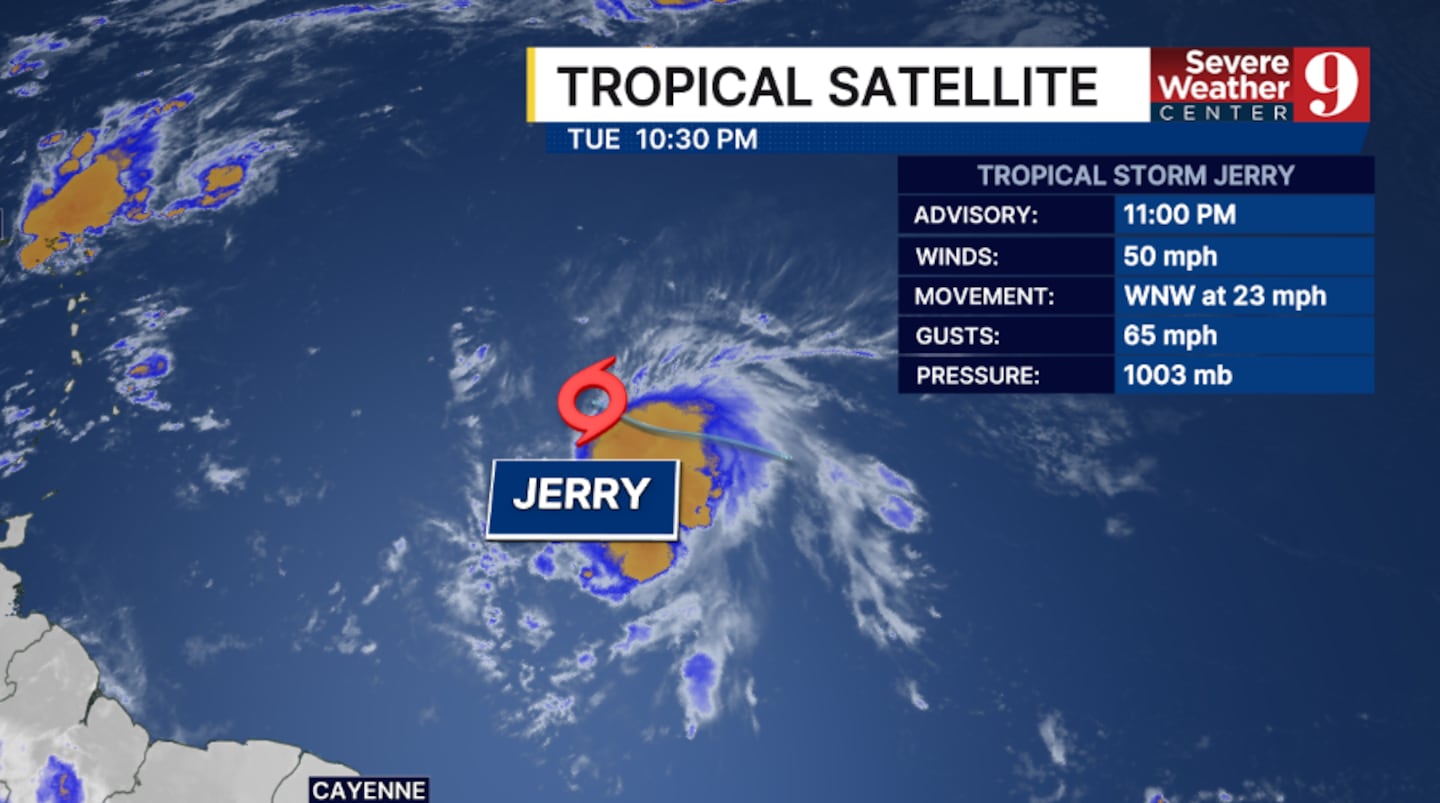
ORLANDO, Fla. — Tropical Storm Jerry remains disorganized Tuesday night as it pushes toward the Lesser Antilles.
The 11 pm advisory from the National Hurricane Center had winds of 50 mph.
Tropical Storm Watches continue for the northern islands of the Lesser Antilles.
Interests in the British and US Virgin Islands should monitor Jerry.
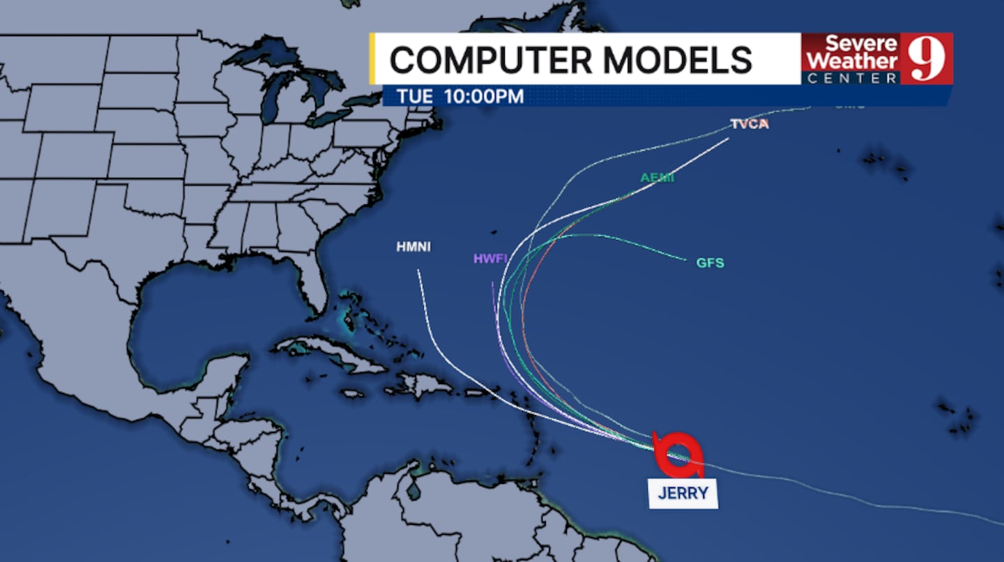
The system is anticipated to strengthen and is forecast to become a hurricane Wednesday night or Thursday.
Jerry is expected to continue to move west-northwestward toward the northern Lesser Antilles through midweek.
It is expected to be near or north of the islands late Thursday and Friday.
In the long term, Jerry is expected to turn northward, which could potentially impact Bermuda late this weekend.
Jerry is anticipated to stay well east of Florida and the United States.
The storm formed Tuesday morning in the open Atlantic. It is the 10th named storm of the 2025 Atlantic hurricane season.
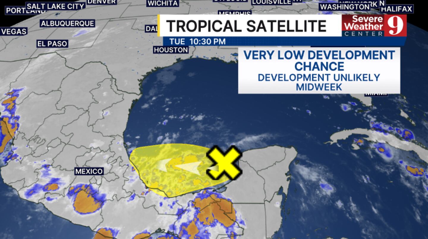
Elsewhere, the National Hurricane Center continues to monitor an area in the Bay of Campeche.
This trough of low pressure is expected to slowly drift westward and is unlikely to organize further.
This currently has a Very Low Development Chance.
Stay with Severe Weather Center 9 for the latest on the tropics.
▶ WATCH CHANNEL 9 EYEWITNESS NEWS

Read:
Read:
Read:
Click here to download our free news, weather and smart TV apps. And click here to stream Channel 9 Eyewitness News live.
©2025 Cox Media Group


 Sign Up

