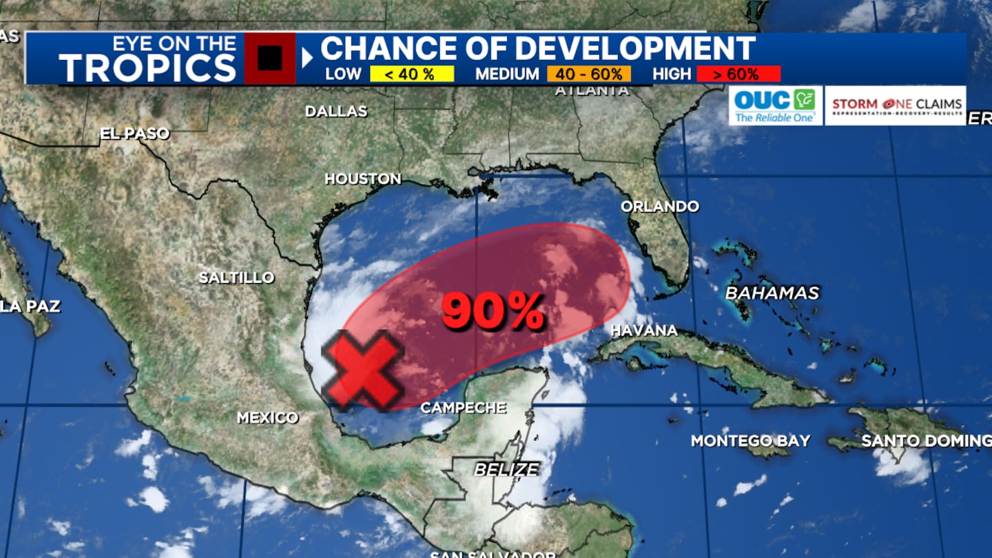
ORLANDO, Fla. — There is an increasing likelihood of tropical development in the Gulf of Mexico over the next 24 to 48 hours.
▶ WATCH CHANNEL 9 EYEWITNESS NEWS
▶ DOWNLOAD OUR APPS
11:00 Update:
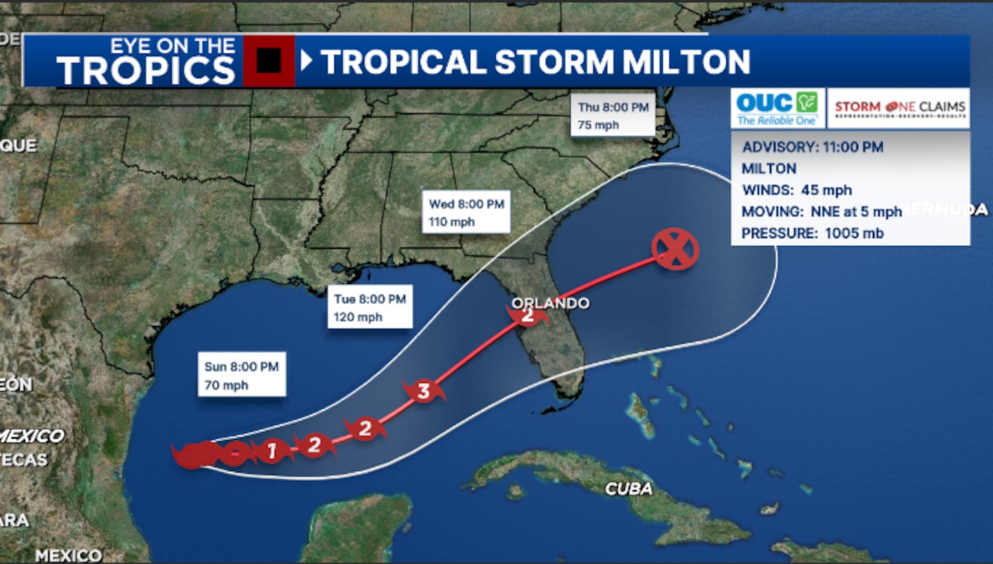
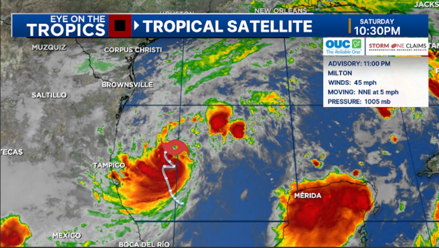
Tropical Storm Milton is now slowly organizing in the Gulf and is on track to be major hurricane as it near Florida.
The 11 pm advisory from the National Hurricane Center showed winds of 45 mph, indicating Milton is strengthening.
The storm is expected to become a hurricane Sunday night and could be a Category 3 major hurricane Tuesday night in the eastern Gulf.
The latest track shows Milton making landfall along the west coast of Florida Wednesday night, then tracking across Central Florida Wednesday night into early Thursday.
The threat continues to increase that Milton will bring significant impacts to parts of the west coast Florida early next week. This includes significant storm surge and hurricane-force winds.
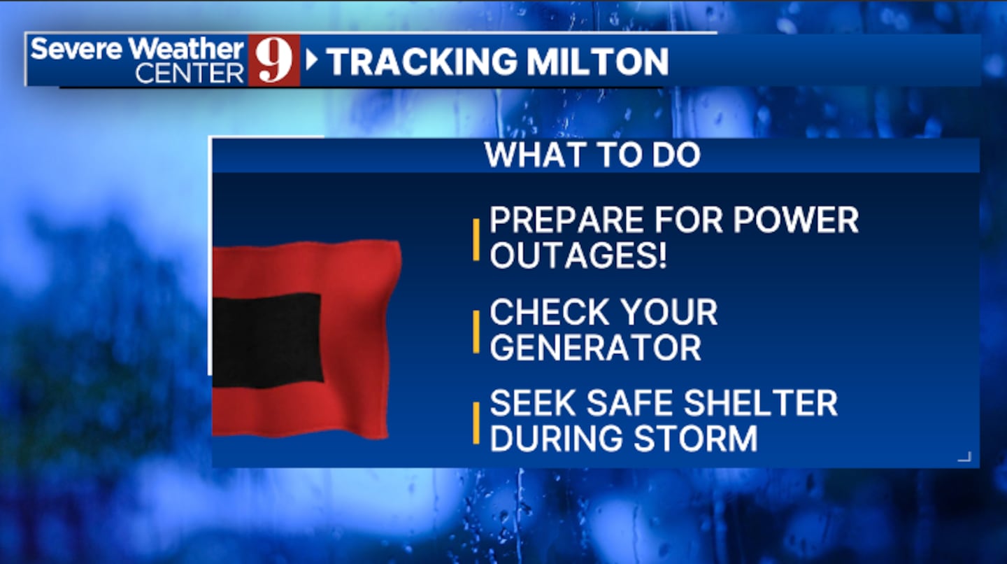
It remains too early to know local impacts, as the exact track of the storm will be critical. However, residents across all of Central Florida should be preparing for a tropical system early next week.
8:00 Update:
6:00 Update:
Gov. Ron DeSantis declared a state of emergency for 35 counties including all of Central Florida.
As Tropical Storm Milton continues to strengthen in the Gulf, I have issued EO 24-214 ahead of potential landfall on Florida’s west coast this week. This EO declares a state of emergency in 35 Florida counties.
— Ron DeSantis (@GovRonDeSantis) October 5, 2024
As many continue to recover from Hurricane Helene, I have directed…
5:00 Update:
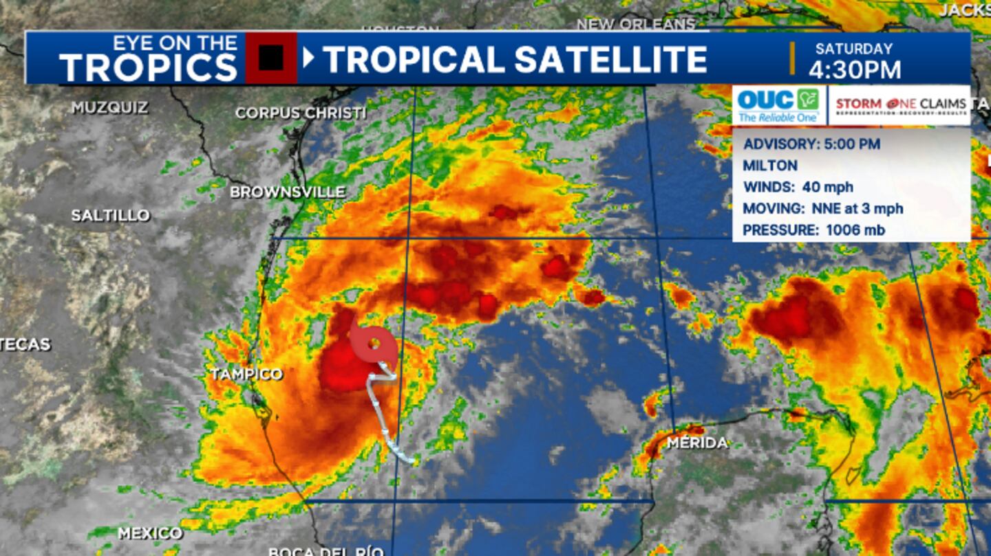
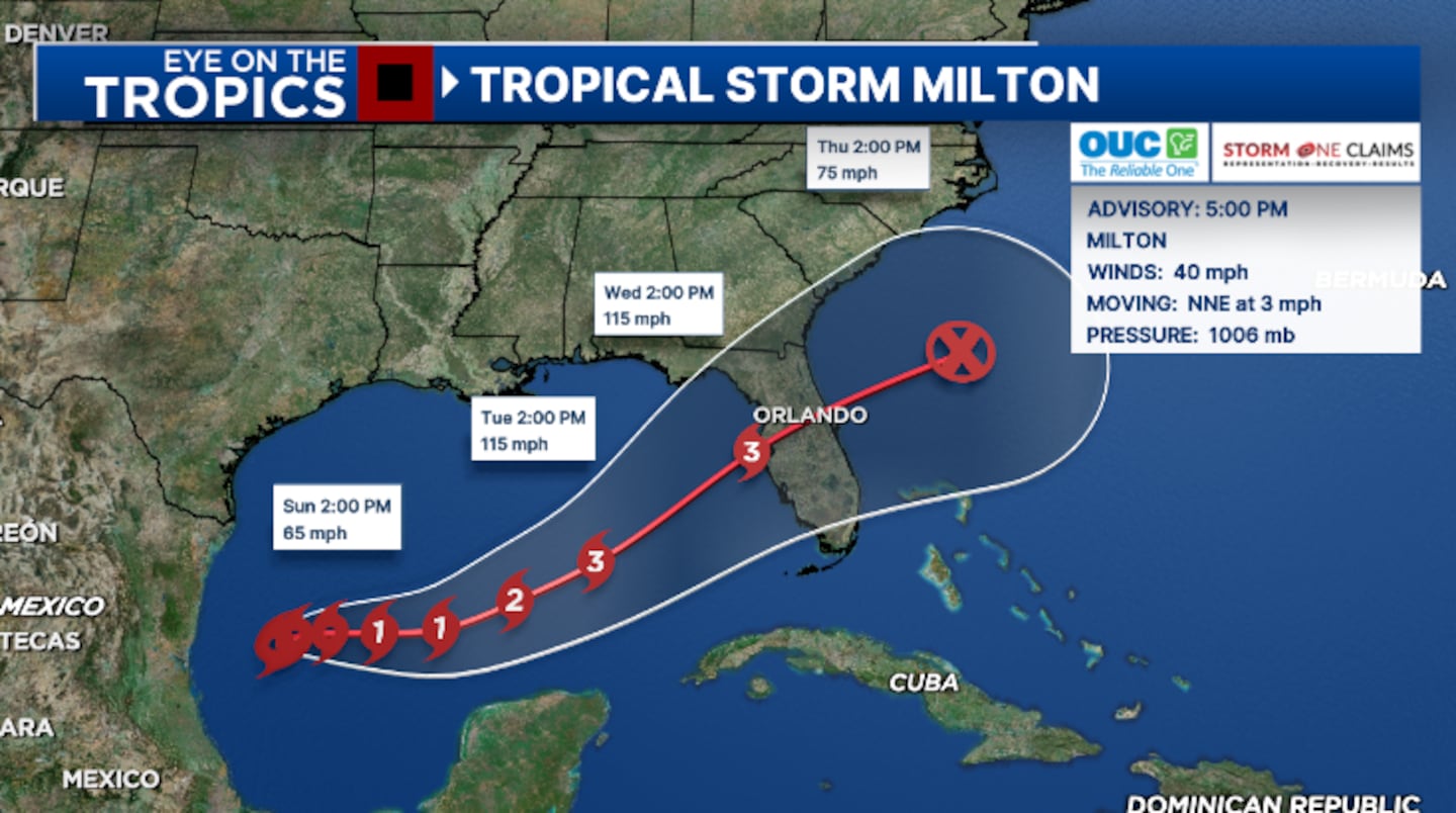
Tropical Storm Milton is now on track to become a major hurricane in the Gulf as it approaches Florida.
The 5 pm advisory from the National Hurricane Center showed winds of 40 mph, keeping Milton a tropical storm.
The storm is expected to become a hurricane Sunday night and could be a Category 3 major hurricane Wednesday as nears landfall along Florida’s west coast.
The latest track shows Milton moving across Central Florida Wednesday and Wednesday night.
It is becoming increasingly likely Milton will bring significant impacts to parts of the west coast Florida early next week. This includes significant storm surge and hurricane-force winds.
It is too early to know local impacts, as the exact track of the storm will be critical. However, residents across all of Central Florida should be preparing for a tropical system early next week.
2:30 p.m. update:
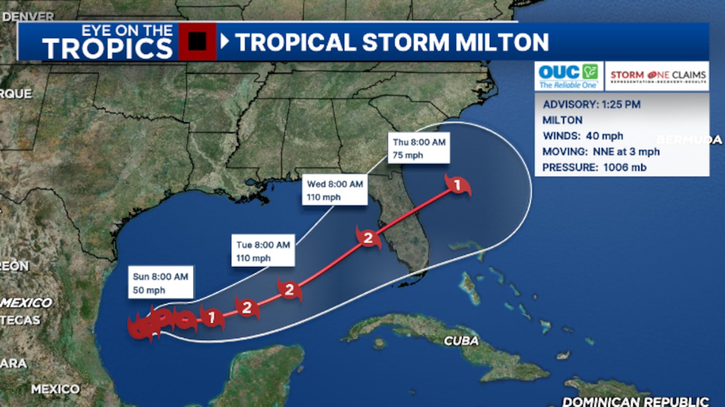
Tropical Depression Fourteen has been upgraded to Tropical Storm Milton and is on track to impact Florida next week.
The National Hurricane Center estimates winds inside the system to be 40 miles per hour, making Milton a named storm.
Milton will likely become a hurricane early Monday and could be a strong Category 2 storm as it nears landfall along the west coast of Florida early-to-mid next week.
Read: Red Cross: Helping after Helene
This storm has potential to produce significant impacts to parts of Florida, depending on the exact track of the system.
Watches will likely be posted for parts of the state on Sunday.
Stay with Channel 9 for updates on this developing storm.
1:44 p.m. update:
Tropical Depression Fourteen has become Tropical Storm Milton.
Winds are at 40 miles per hour.
1225 PM CDT Oct 5: Depression becomes Tropical Storm #Milton Stay up to date with the latest forecast at https://t.co/tW4KeGe9uJ pic.twitter.com/7faKFL0kkO
— National Hurricane Center (@NHC_Atlantic) October 5, 2024
1:11 p.m. update:
The City of Daytona Beach will provide sandbag materials to residents from 9 a.m. to 3 p.m. on Sunday, Oct. 6, at Bethune Point Park.
Residents are asked to bring shovels to fill sandbags.
Read: Central Florida to enjoy warm, partly cloudy Saturday with minimal rain chances
The sandbags are free, and there is a 10-bag limit per vehicle.
Officials said city personnel will be on hand to help residents needing assistance.
12:42 p.m. update:
The City of New Smyrna Beach said sandbags will be available 24 hours a day next to the Sports Complex football stadium at 2335 Sunset Drive.
New Smyrna Beach residents can access sand piles and fillable bags.
There is a limit of 15 bags per resident.
Read: Hurricane tips: What you should do to prepare
11 a.m. update:
Tropical Depression 14 has developed in the South West of the Gulf of Mexico.
This storm is expected to strengthen over the next couple of days as it approaches the Florida Peninsula.
Potentially making landfall on our west coast as early as Wednesday morning, as a Category 2 storm.
Read: Central Florida braces for heavy rain with free sandbag stations
This will bring significant impacts to parts of Florida.
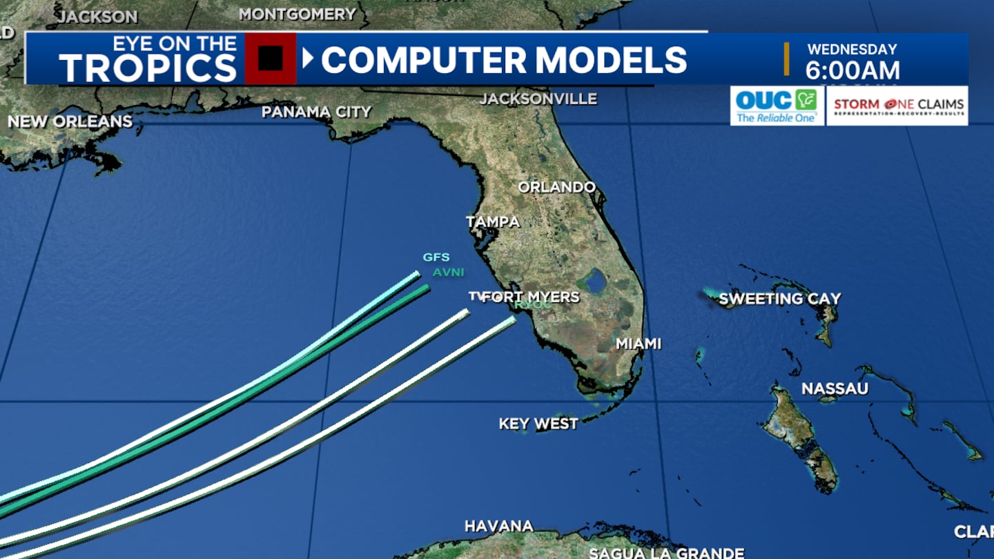
The severity of our local impacts will be determined by how far north this system makes landfall.
If it makes landfall closer to Tampa, we will experience hurricane conditions in many of our Central FL communities.
Original Story:
Right now invest 92-L will become Milton by the end of the weekend.
Regardless of development, excessive rain will be in the forecast for parts of the Florida Peninsula from Sunday to Wednesday.
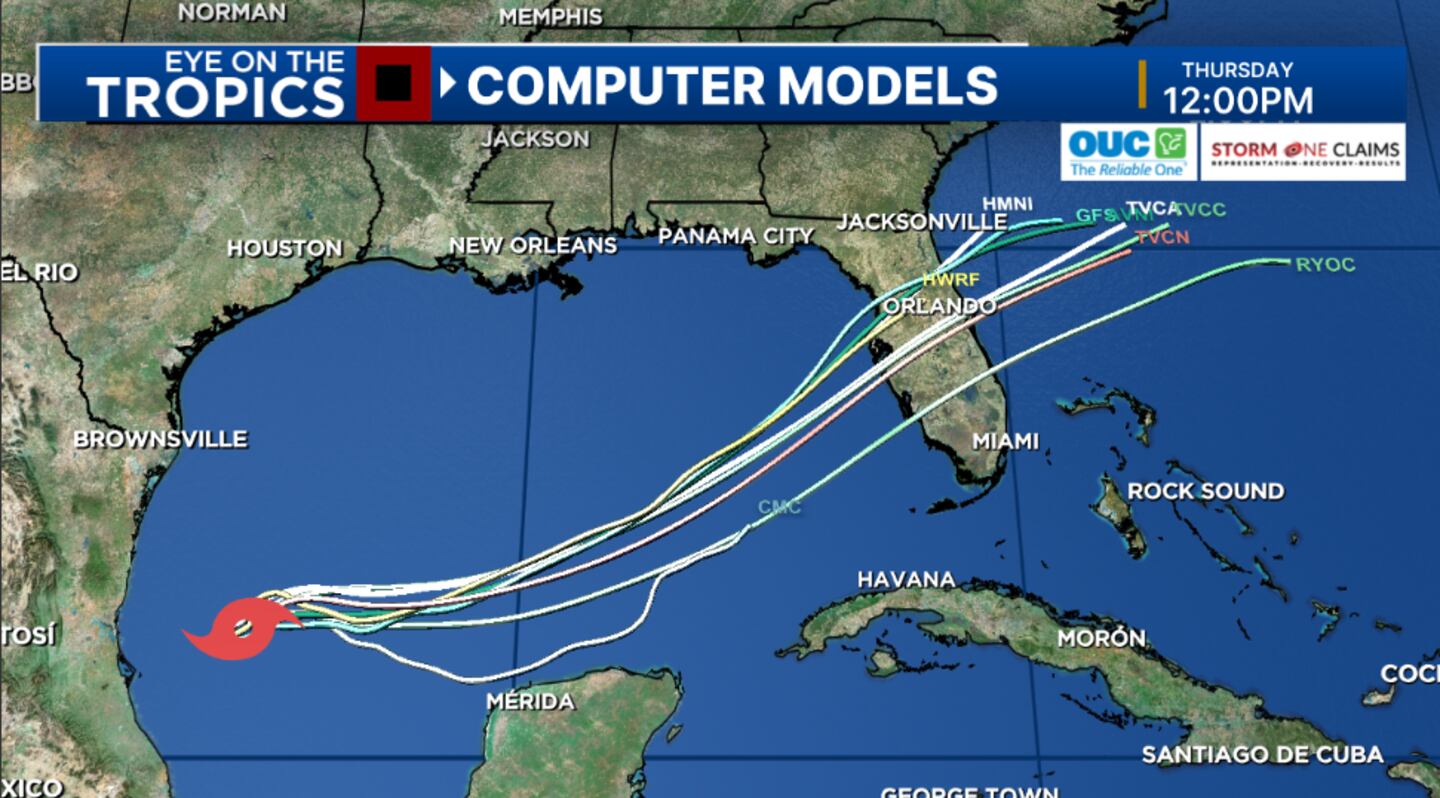
Early models indicate that Florida could have an approaching tropical system as early as Wednesday.
READ: Odds increase for tropical system to develop in Gulf next week
Hurricane Kirk remains a major hurricane in the Central Atlantic.
Thankfully, Kirk is forecast to stay out to sea.
But it will be sending swells our direction. Dangerous seas expected along our east coast.
Hurricane Leslie is right behind Kirk and is also slowly moving through the Central Atlantic.
Channel 9 will continue to monitor all active systems in the tropics and provide updates on Eyewitness News.Click here to download our free news, weather and smart TV apps. And click here to stream Channel 9 Eyewitness News live.
©2024 Cox Media Group


